|
|
 |
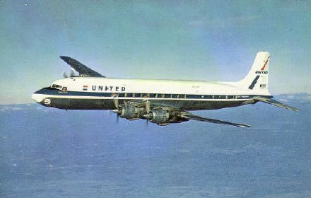 |
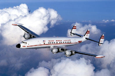
June 30, 1956; A midair collision over the Grand Canyon involving TWA Super Constellation L-1049 N6902C, Star of the Seine and United Airlines DC-7 N6324C, City of Vancouver.
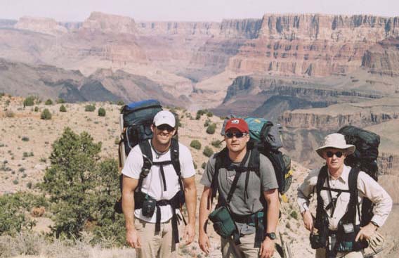
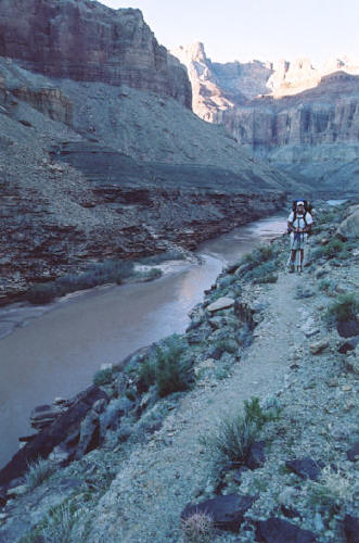
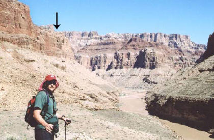
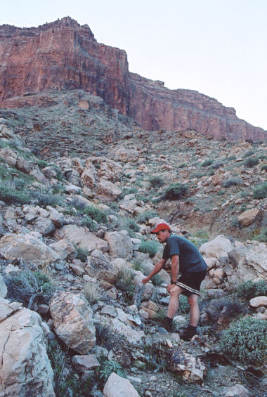
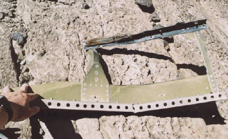
Both planes departed Los Angeles International Airport within three minutes of each other on the morning of June 30th. The Trans World Airline L-1049 Super Constellation, Flight 2, was en route to Kansas City while the United Airlines DC-7, Flight 718, was headed for Chicago. The TWA's flight plans were to fly at 19,000 feet and fly at 310 mph. From Los Angeles, the Constellation would fly to Daggett, California to Trinidad, Colorado to her final destination of Kansas City, Missouri. The United DC-7 was to fly at 21,000 feet at 330 mph. She would continue to Needles, California then to Durango, Colorado and on to Chicago, Illinois. Both planes were to cross each other paths with a 2,00 foot difference over the Painted Desert on the eastern side of the Grand Canyon. In the meantime, thunderclouds were forming over the Grand Canyon and northern Arizona. As the TWA approached Daggett, California the pilot, Captain Jack Gandy, requested the TWA ground operator that he be able to increase his altitude from 19,000 feet to 21,000 feet. The TWA operator contacted Los Angeles Air Traffic Control, who denied the request with "You have United 718 crossing his altitude- in his way at two one thousand." The TWA operator then radioed to Captain Gandy, "TWA Flight 2, unable to approve two one thousand." Captain Gandy then requested to fly "1,000 on top", which meant he would like to fly 1,000 feet on top of the foul weather conditions. This meant that at this altitude it should be adequate to fly with visual flight rules; the "see and be seen" rule. The controller then issued a clearance with a warning; "ATC clears TWA Flight 2, maintain at least 1,000 feet on top. Advise TWA 2 his traffic is United 718, direct to Durango, and estimating Needles, California at 9:57 am." Back in 1956, the Air Traffic Control was responsible for separating planes by means of altitudes in adverse weather. This is why TWA was denied their initial request. However, if a pilot requested visual flight rules, then the Air Traffic Control had no responsibility since it was presumed that the aircraft would see each other. At 10:13 am, the Salt Lake controller had just received the latest position reports from both aircraft. Interestingly, he knew that both planes were at 21,000 feet, and would cross each others paths over the Painted Desert at the same moment, but he did not advise the airliners of this. According to the Civil Aeronautics Administration rules, he was not required to as they were flying VFR! Little is known as to what happened in the seconds prior to the collision. It is likely that the planes were flying through and around cloudbanks trying to give the passengers a better view of the Grand Canyon when the collision occurred. It was a common practice then for pilots to deviate from their route slightly to offer a great view. Did they collide while in a cloudbank where there was little visibility, or, were they in each other's blind spot? This is something that will never be known as this was before the days of black-box cockpit recorders. Most likely, the passengers and crew in the TWA never saw the United DC-7 as it came from above and to the rear of the TWA Constellation. At 10:31 am, about a mile southwest of the confluence of the Colorado and Little Colorado Rivers, the planes collided at 21,000 feet. The United DC-7's left wing struck the TWA's tail, and as the DC-7 slid on the top of the Connie's fuselage, the DC-7's propellers struck the TWA fuselage. The propeller blades ripped open the rear cabin on the TWA's fuselage and severed the tail section, sending the TWA into a four mile vertical dive to the canyon floor at the base of Temple Butte, where a fiery crash ensued. The tail section came to rest 550 yards north of the impact area of the Constellation. Magazines, blankets and other light items that had been sucked out of the pressurized fuselage at 21,000 feet had floated to earth and were scattered on both sides of the Colorado River. The tower at Salt Lake received a message that was not decipherable at first. It was the voice of a man with concern and anxiety in his voice. It was later determined to be that of the United Airlines DC-7 pilot, Captain Robert Shirley. Upon realizing what had happened, he radioed in, "Salt Lake, United 718,...uh... we're going in." The United DC-7, only missing it's outer left wing panel, still had lift, but not enough to save her. The plane hit at the top of an 800 foot high sheer cliff on Chuar Butte. At 10:31 am, neither plane reported passing over the Painted Desert. After repeated attempts of trying to contact both aircraft, the CAA initiated a missing aircraft report at 11:51 am. Tragically, 128 people were killed in the two airliners. The wreckage of both planes was left on the buttes until the Park Service contracted a firm to remove it in the late 1970's. Today, there are only small parts left at the TWA impact site on Temple Butte. Since the United Airlines DC-7 crashed high on a bluff and in an inaccessible spot on Chuar Butte, much of it is still left in the rocky crags of the cliff's south face, and can be spotted from the river rafts passing by. As most of you know, my interest is in military aviation mishaps, but this is the one exception due to the circumstances regarding the crash, and the incredible difficulty just to get there, as I enjoy the challenge. Hands down, this is the most difficult crash site I have been to. The hike was 18 miles in, and required two days just to get to the confluence of the rivers. Then one has to cross the Colorado River to visit the site. The TWA crash site was reached on the third day. After that, cross the river again and spend two more days hiking out. The trip consisted of 36 miles round-trip, of which a back-country permit is required. |
 |
 |
 |
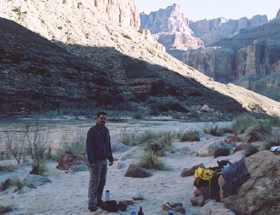 |
| Standing on the edge at Lipan Point. The arrow is pointing to Temple Butte, where the TWA Constellation crashed. | Half-way there, and with two great friends; Brad, myself, and Jim. Temple Butte is above and to the left of Brad. | On the Beamer Trail which is inches away from a 400 foot drop to the Colorado River. | Me on the third morning of the hike, packing my gear and prepping to cross the Colorado River. |
 |
|
 |
 |
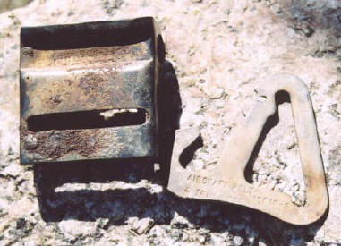
| Standing at the base of Chuar Butte. The arrow indicates where the United DC-7 impacted at the top of a cliff. | Chuar Butte 15 miles away. | Seat belt buckle and fastener at the TWA site. | Looking over the TWA Constellation impact area on Temple Butte. Even though the large parts are gone, a burn area and smaller debris remain. |
 |
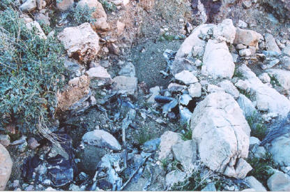 |
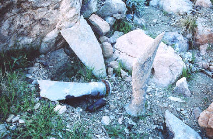 |
 |
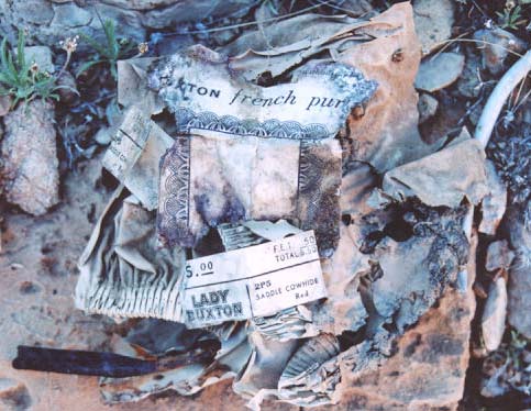
| The receipt and what may have been a purse at the TWA site. The advertisement is for a Lady Buxton French Purse. (Note that nothing can be removed from the sites without a proper permit) | Debris at the Connie site. | Three propeller blade shafts at the TWA site. | One of the many parts found between both crashes that fell off as the planes fell to the ground. |